Oct 1, 2026
Welcome to the September 2026 edition of the MapLibre newsletter! A special thanks to our sponsor, Mapme, for their renewed sponsorship and steadfast support since 2024. This month is packed with major milestones across projects. Let’s dive right in!


Sincere thanks to Mapme for their continuous backing since 2024 🤝.
MapLibre Native
Cross-platform Plugin System
An update on the new cross-platform plugin system for MapLibre Native.
🚀 A first version of the C Plugin API has landed this month!
We also already saw various PRs (#4654, #4692, #4665) that extended the capabilities of the plugin system. This is exactly the approach that we want to take: gradually expand the scope of the plugin system to make sure it fits all the use cases that our users have.
It should be noted that during this development phase the plugin system is not stable yet. Regular builds also do not include it yet (all integration code is guarded with a MLN_WITH_PLUGINS build flag). However, for those that want to experiment with the plugin API already, we did put out a pre-release for MapLibre Android that includes it. Please see this repository for an example. MapLibre iOS will follow suit.
Note that these plugins tie directly into the core. The plugins are cross-platform, and thanks to the C API, once the API is stable, people will be able to publish plugins that will continue working across versions. We believe that this has the potential to create a true plugin ecosystem for MapLibre Native. By having a powerful plugin system, we allow people to extend the library and experiment, while keeping the core library stable (and small). Below you can find a small taste of some interesting ideas.


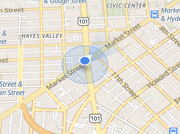
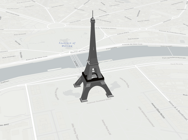

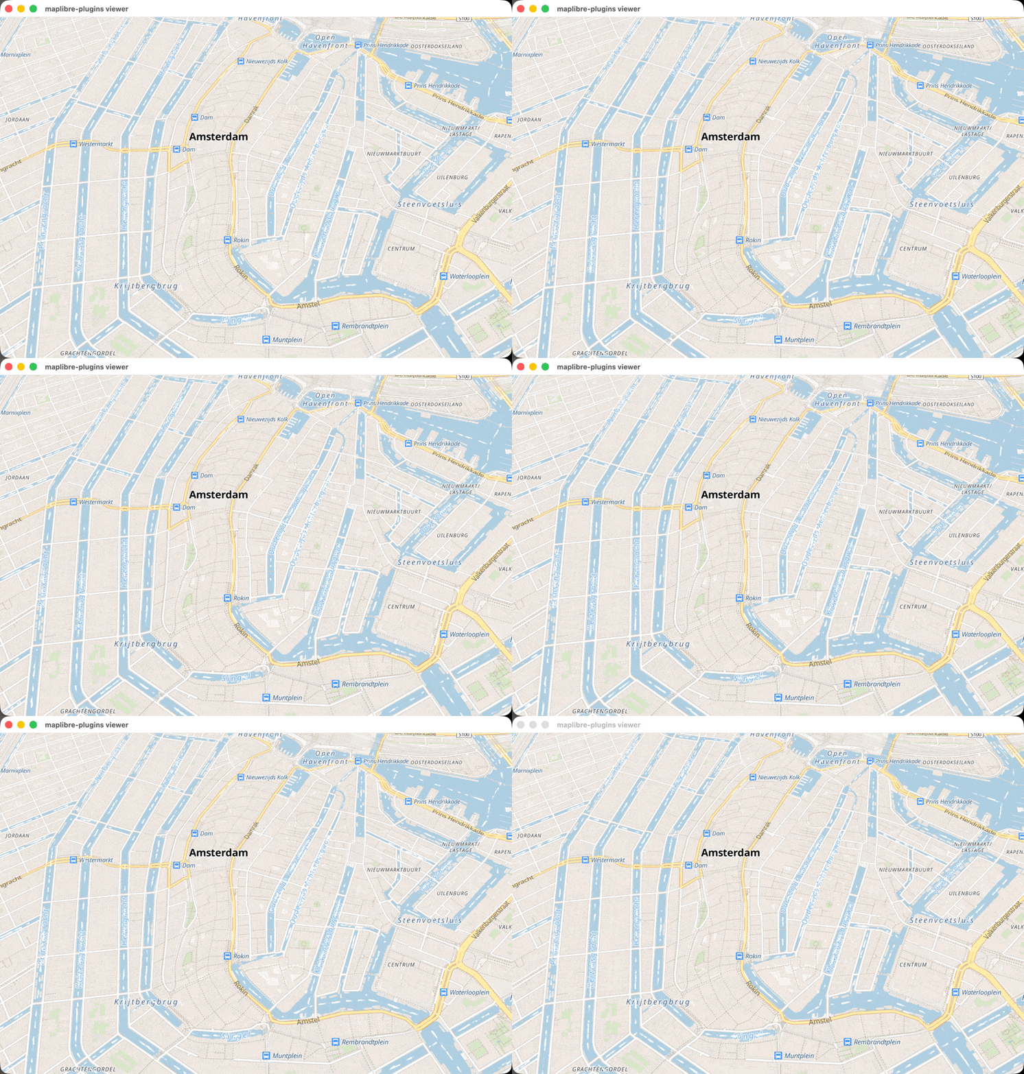

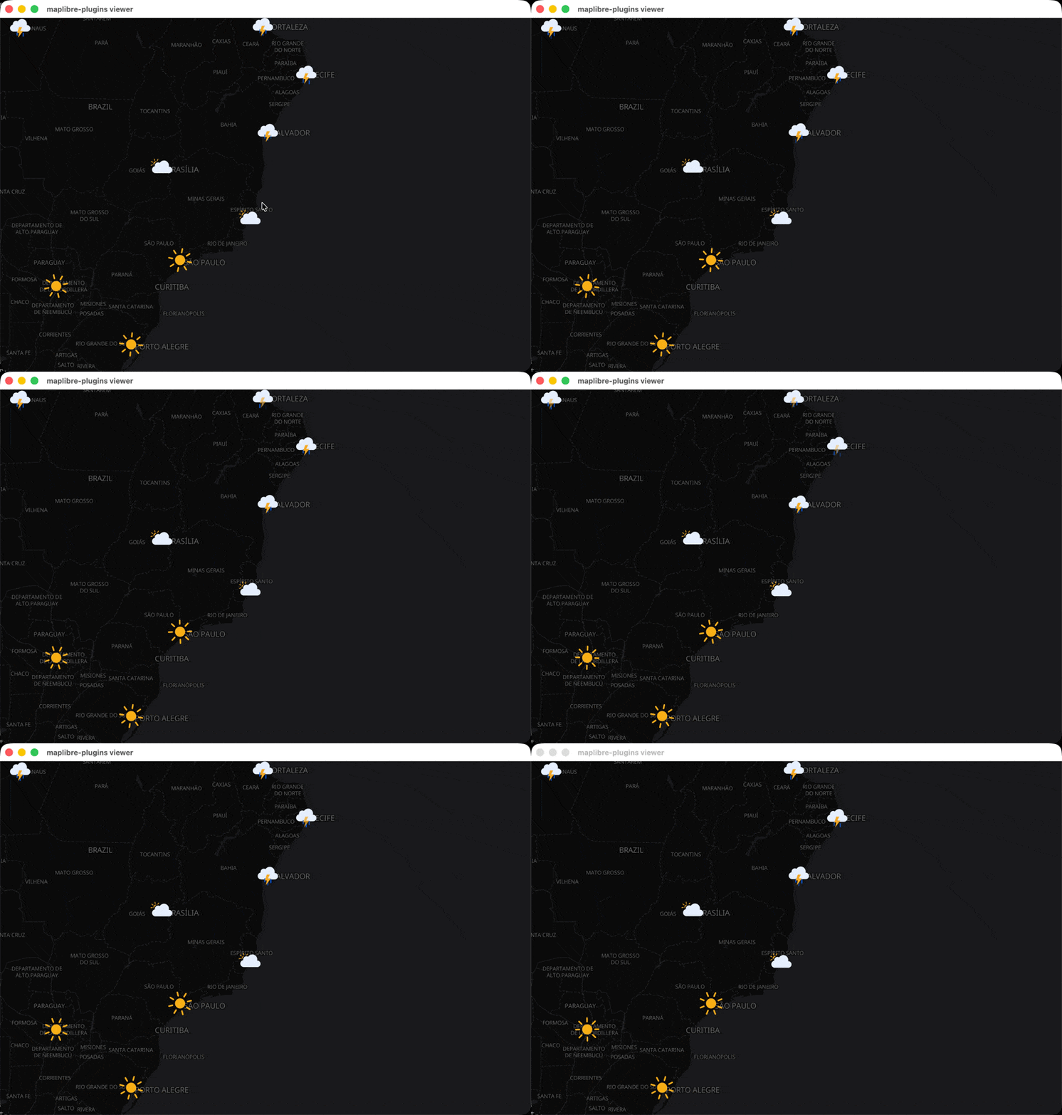
Examples of plugins that the new plugin API enables: waves, an n-gon layer, custom location indicators, 3D models, fireworks, flow direction, snow and animated symbols (click to enlarge). Thanks to Sargun Vohra for sharing his experiments. Map data from OpenStreetMap and styles based on OpenMapTiles shown.
Ongoing Terrain3D work
Terrain3D is a work-in-progress, with people still hacking away at the feature/terrain-3d branch until it can be declared feature complete and stable. Patrik Drhlik decided to become an early adopter and try it out. He shared the following promising video:
Terrain3D in Patrik’s MapRiot app.
OpenHarmony Platform
With #4315 merged we now have a new platform: OpenHarmony. OpenHarmony has about 20% smartphone market share in China and about 5% globally. What makes this platform interesting as well is Oniro. This is an Eclipse Foundation Project that builds on OpenHarmony and is “dedicated to the development of an open source vendor-neutral Operating System (OS) platform”.
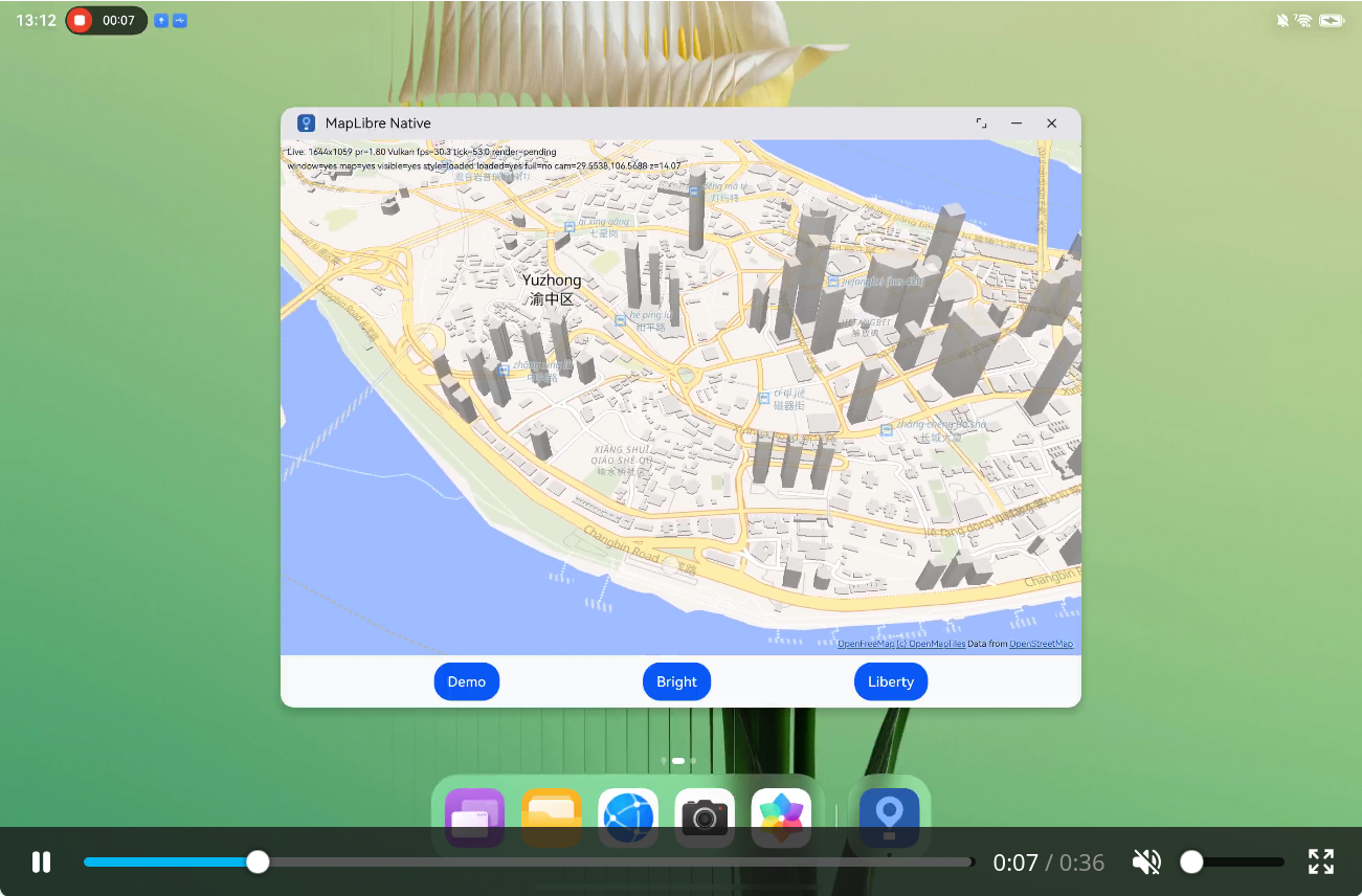
MapLibre Native running on OpenHarmony, this interactive sample is included in the platform and can use either Vulkan or OpenGL ES.
Call for MapLibre Accessibility Features
Tim Sylvester implemented the ability to introspect rendered features in #4460 this month. While this functionality was built primarily with testing purposes in mind, it might offer some opportunities for MapLibre Native to better integrate with accessibility tools such as screen readers. We would be very eager to hear from people willing to share their ideas on how to push such accessibility efforts.
Other news
- Android can now load PMTiles directly from APK assets, allowing apps to bundle offline tile archives in this format.
- The
semiliteralexpression is now supported in Native, matching GL JS. It allows array-valued properties, such as text offsets, to contain elements calculated using expressions.
Releases
| Platform | Latest Versions |
|---|---|
| Android | 13.5.2 , 13.6.1 , 13.6.1 pre-release (with plugin API) |
| iOS | 6.30.0 , 6.31.0 |
🌐 MapLibre GL JS
💪 We did a large sweep this month over the open issues and closed about 80 of them (~25%). We also swept through the PRs and revived some stale ones. Many thanks to John Carmack for driving this effort!
Additionally we have added support for the font-faces style spec property, officially closing one of the last major gaps between native and web.
We released 8 versions this month: 6.7, 6.8, 6.9, 6.9.1, 6.10, 6.11, 6.11.1 and 6.11.2. These versions are packed with new features, fixes and improvements. Our pace is increasing dramatically with the extensive use of AI, but we make sure to fully review and test all the code that ships in order to keep our quality high. Check out our AI contribution policy in the contributing guide.
Here are some highlights from these releases, although there are too many to list:
- The
font-facesstyle spec property is now supported, which allows using font files with MapLibre. This was one of the last gaps between native and web, and it is now closed. - Along with the above addition, we have improved out-of-the-box support for all kinds of complex script languages and made RTL an out-of-the-box feature that doesn’t require an external plugin.
- The terrain feature is finally production-grade: for a long time terrain performance was lacking, especially on mobile devices, and there were a lot of bugs related to “jumps”. Recent versions have made it smooth and fast.
- There were some sky-related bug fixes and improvements, so the sky looks a lot better — try it out!
- A lot of small performance improvements to increase the Lighthouse ranking.
💙 As always, we would like to thank all the contributors this month, this wouldn’t have been possible without your help!





















🦀 Martin
Martin 2.0 is now officially in beta! Test it against your setup and check out our new migration guide.
We released 3 versions this month: 1.16.0, 1.16.1 and the first beta of Martin 2.0 (2.0.0-beta.0).
We merged more than 150 non-bot PRs, and Martin 2.0 is now in beta.
Please try the beta against your setup and tell us what breaks.
We have written a migration guide:
2.0 removes the options that v1.x and v0.x deprecated, changes some defaults and needs PostGIS 3.5 or newer.
If Martin 1.16 starts without deprecation warnings for you, you’re probably fine (the only un-warned change is martin-cp -> martin cp).
Here are some highlights:
- Tile grids other than Web Mercator: PostgreSQL, MBTiles and PMTiles sources can now be served
on other grids, such as national or polar ones. Seven grids from the OGC registry are built in
(for example
NZTM2000Quad), and you can define your own in the config. - Server-side rendering is stable: It is no longer experimental. It has moved out of the
default build into the
-fullDocker images and tarballs due to having some shared library version dependencies. - Faster startup: Martin accepts connections while its sources are still loading, and PostgreSQL discovery does less work per table.
/healthstill only reports ready once everything has loaded. - Aliases for fonts, sprites and tile sources: give a font fallback stack, a sprite set or a set of tile sources one name, and a style can request it like a single source.
- CQL2 filters on table sources: write
filter: population > 100000on a table instead of writing a SQL function. - A terminal dashboard shows sources, request rates, a live world map of tile requests and the log. In 2.0 it is on by default in an interactive terminal (
--no-tuiturns it off). martin-cpis now themartin cpsubcommand. It can skip now also skip tiles below an empty tile, which took a world copy from 243s down to 11s on our test database.- Performance work on the tile cache: on a warm cache, serving a tile’s content dropped from 107µs to 29µs.
- Unstable (feature-gated) work continued on DuckDB/GeoParquet sources (
s3://,hf://and more,.duckdbfiles, hot reload) and on remote COG sources.
As always, we would like to thank all the contributors this month, this wouldn’t have been possible without your help!


MapLibre Tiles (MLT)
📦 Announcement: MLT v2 has evolved from a spec skeleton into a fully working format complete with its own high-performance Rust encoder/decoder, docs, and interactive inspector.
This month was about MLT v2. It went from a header and metadata skeleton to a working format with its own encoder, decoder, docs and inspector. Everything MLTv2 is still behind the unstable-v2 feature while there are still unresolved questions (see below).
We shipped 13 releases of mlt-core (0.12.7 -> 0.16.0), along with the mlt CLI, the FFI, WASM and Python bindings, and @maplibre/mlt 1.2.1 and 1.3.0.
Here are some highlights, although there are too many to list:
- Every column kind now round-trips in v2. That covers strings, floats, nested properties and m-values. Nested properties use an ORC-style node tree, and a nested node’s structure is written once per row instead of once per entry. That saves 13.6% on a group of name* columns and 9.8% on a bag of all properties.
- Strings. Dictionaries are front-coded, and a layer can share one dictionary across columns. Together that cuts the whole tile by 18.3% on OpenMapTiles and 21.5% on the tiles that one of our sponsors Amazon provided.
- Floats. A float column can be stored as a dictionary or with ALP, which is chosen only when every value comes back bit for bit. ALP stores a frame of reference, races FastPFOR against varint for its offsets, and packs its two parameters into a single byte. This cuts decimal columns by 19.5% and makes the parameter search about 10x faster.
- Smaller headers.
- The extent fits in a nibble.
- The column and m-value counts share one variant.
- Raw streams with a fixed element width no longer store their byte length.
- The spare nibble in the layer header now holds the geometry type when a layer has only one. About 60% of layers are like this and no longer write a types stream.
- Geometry. Dictionary and tessellated layouts have been merged. A layer made only of tessellated polygons stores can store just its triangles, and triangle indices count from the layer’s first vertex instead of relatively to the start.
- Presence and dictionary codes. Dictionary children share their parent’s presence bitfield, presence can be run-length encoded again (up to 4% smaller), and dictionary codes are bit-packed when that beats one varint per code.
- Tile inspector. The new inspector is built on our WASM bindings to the high performance rust encoder/decoder. It shows a hex view of the tile next to a tree of its regions, draws the geometry, loads tiles from a URL, and has filters with live counts. Check it out -> https://maplibre.org/maplibre-tile-spec/inspector/
- We have also rewritten most of our docs and it should be much more approachable. If something is unclear, that is a bug and we would love your questions.
- We have also done a bunch of Hardening.
- Malformed FSST data, oversized dictionary child counts, vertex index overflow and float encodings that don’t fit are now rejected instead of panicking.
- Polygon rings with no area are skipped during tessellation.
- Tests moved to cargo-nextest, with a big push on coverage of the error paths in the codecs.
- Cleanup. We removed the Pseudodecimal encoding, which was never implemented, the Java encoding server, the (currently sadly unmaintained) C++ encoder from CI.
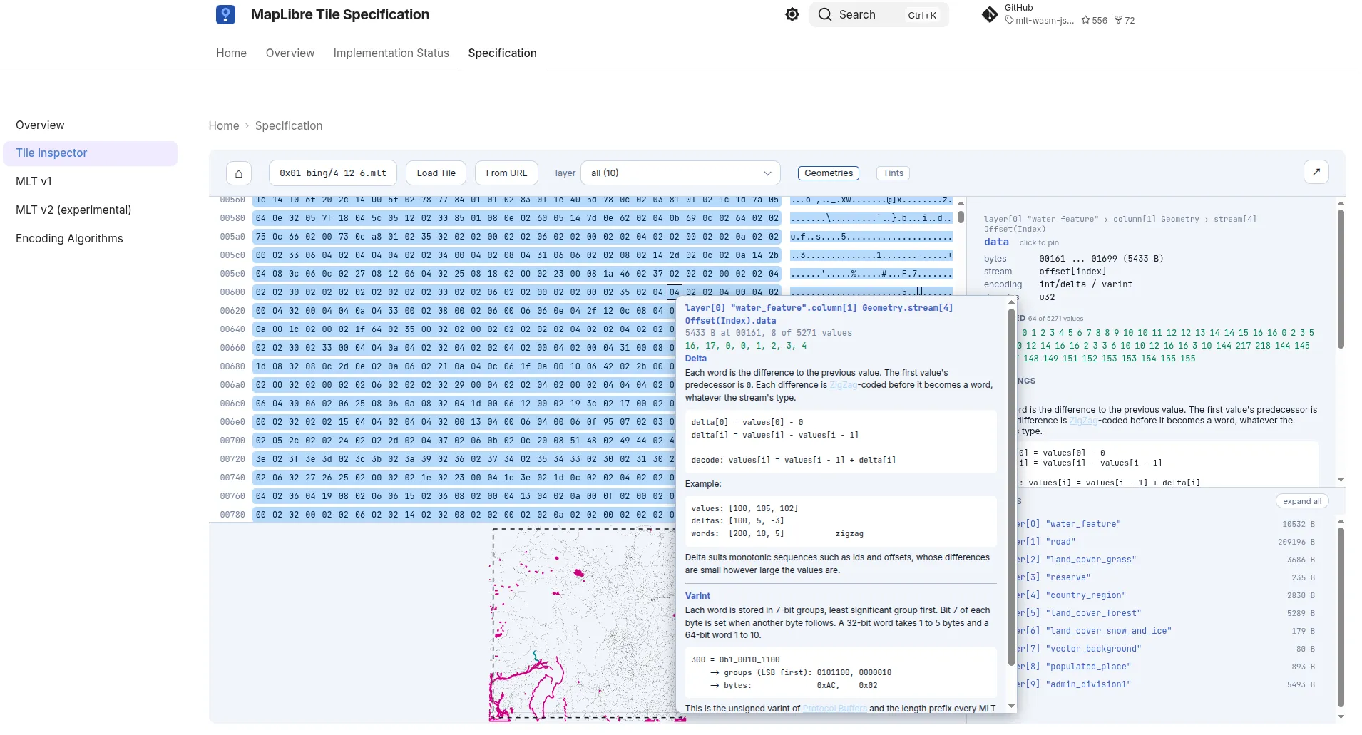
MapLibre Tiles v2 Inspector
In terms of what we are still discussing (please join our slack channel 😉) before we can move for stabilization:
- Do we want
rANSentropy coding for vertex streams that are smaller, but also 15% slower to decode and more complex? - Does the proposed z coordinate system work for all use cases that are planned?
- Do we want to remove the unused Morton encoding variants?
🎨 MapLibre Compose
Over the past couple of months, MapLibre Compose has shipped a shared implementation for Android, iOS, and desktop built on MapLibre Native FFI. These releases closed nearly all the previously open issues (about 80!), completed feature parity work for desktop and web, including map styling and proper compositing with Compose UI, added long-requested features including a map snapshotter and imperative styling APIs, plus support and demos for integrating maps with Android Auto and CarPlay.
StreetComplete, the OpenStreetMap surveying app, has also merged its migration from direct MapLibre Native Android integration to MapLibre Compose, sharing its map implementation across Android and iOS.
MapLibre Compose is now essentially feature-complete, except for Kotlin Wasm support which is in draft until the next Compose Multiplatform release. The remaining work before 1.0 is improving documentation, performance, finding and squashing bugs, and improving API ergonomics. User feedback is especially important at this stage.
✨ Community Spotlight
MapLibre Navigation SDK 5.0.0
Version 5.0.0 of the MapLibre Navigation SDK has been released, bringing KMP compatibility and major improvements! Huge thanks to Fabian Keunecke for the great work! 🎉
Tel Aviv 2035
Tel Aviv 2035: A 3D map of Tel Aviv-Yafo built in just one hour with MapLibre GL JS at the Fable 5.1 Build Day on September 17, 2026, where it won the Breakthrough track!
- Repo (MIT): github.com/benjddd/fable-build-day-tlv-2026 (tag
build-day-2026-09-17-winner; seeMAKING_OF.md) - Live App: tlvnext.com | Short Film: Watch here
About the Build: Built as a one-page web app using MapLibre GL JS fill-extrusion over municipality raster orthophotos (1997–2025).
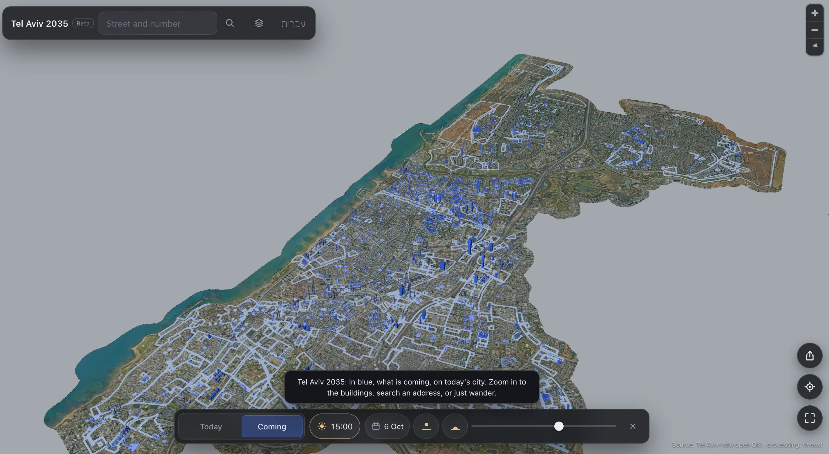
Tel Aviv 2035: existing buildings coloured by year, with permitted and planned volumes in blue
🗓️ Monthly meetings
We continue our regular community calls on the second Wednesday of each month, with an additional session on the last Wednesday to better accommodate Asia/Oceania time zones. As an exception, this month we will have it one day earlier to accommodate maintainer’s availability.
Upcoming Calls
- MapLibre Native: Oct 13, 2026 – 7:00–8:00 PM Berlin Time (UTC+2)
- MapLibre GL JS: Oct 13, 2026 – 8:00–9:00 PM Berlin Time (UTC+2)
🌏 MapLibre Eastern Call
Held on the last Wednesday of the month at an Asia/Oceania-friendly hour:
- Oct 28, 2026 – 9–10:00 AM UTC
All calls are open to everyone. Zoom links are shared in the MapLibre Slack.
Not yet a member? Request an invite via the OpenStreetMap US Slack and join the #maplibre channel.
We’d love to see you there!