← Back to MapLibre Native roadmap
Goals:
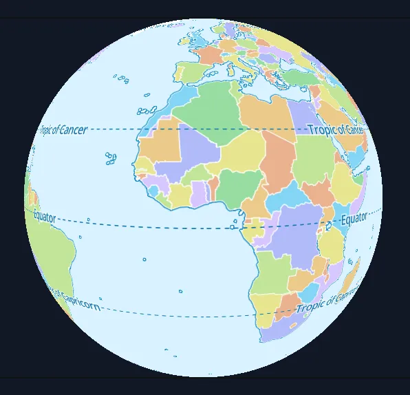
- Zoom out via Adaptive Composite Map Projection
- Ability to show and interact with Globe (or alternative view on earth) when map is zoomed out - while reusing and loading the same Mercator vector tile and raster data - client side reprojection of the data - using Adaptive Composite Map Projection - where deeply zoomed you are in Mercator - but from certain zoom level up there is transition to another projection.